
Another example of how cloud GIS may be used in local government projects comes from Mihai Iepure, Faculty of Geography, Babes-Bolay University Cluj-Napoca. Mihai Iepure wrote a case study in which he describes his implementation of GIS technology with a goal to assist the process of modernization of local heating network.
Namely, District heating Maintenance and Upgrade, in charge of the supply of heating and hot water in a district in City of Cluj, as well as in other parts of Romania, faces serious challenges due to the fact that in the last decade more than 50,000 apartments have disconnected from the system and switched to micro-heating units.* In order to preserve the district heating infrastructure, it was important to make the system more efficient by improving its maintenance and monitoring, which was the one of potential uses of Mihai Iepure’s project in the future and which could pave the way for modernization of district heating system. His main idea was conceived as a way to assist the citizens of Cluj-Napoca in managing their own district heating needs by helping them with an interactive overview of heating infrastructure. * * * *
Mihai Iepure – Faculty of Geography, Babes-Bolyai University Cluj-Napoca:
“If we were to look at the GIS implementation in local administration in Cluj-Napoca, the second largest city in Romania, surpassed only by the capital city, Bucharest, there is not much to see. The institutions are not very happy to invest money in something they do not believe in. They see only the financial part of the investment, but not the results and benefits this new technology brings. The same thing goes with the Autonomous Administration for District Heating (AADH). At the moment, AADH does not use any kind of GIS, even though large amounts of money have been invested in the development, modernization and keeping up-to-date the public heating network in Cluj-Napoca. Having this in mind, I thought why not create an application for everybody to use to ease somehow the “relationship” between the AADH, as provider of service, and the population, as recipient.
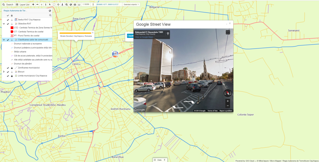
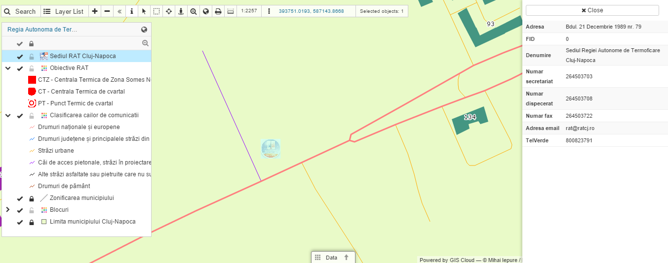
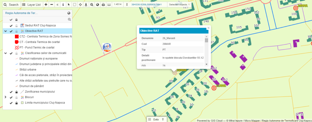
First step was to gather information about the district heating power plants, like the exact position (address, WGS84 and Stereo 70 coordinates), water temperatures, contact information in case of emergency, pipe types, isolation material used for the pipes and other types of data provided by the AADH. The second step was to contact a local cartography and GIS company, MicroMapper SRL. They provided the graphical database of the application. Working with the datasets was done in a local ArcGIS environment, and for the upload on the GIS Cloud platform, the GIS Cloud’s Publisher for ArcMap extension was used. The extension was very helpful because the uploading process went very smooth, and most importantly, the feature symbology was not altered. The webmap was featured in a couple of articles in the online version of two*local newspapers: http://goo.gl/8STlz5 and http://goo.gl/ZY5rmk , with more than 1,000 views.”
You can see the results of Mihai Iepure’s project, edited with the help of GIS Cloud’s Map Editor here.
Mihai Iepure’s project resulted in an interactive web map which was easy to access and navigate by any of the Cluj-Napoca’s residents. Now they could easily find the data they needed by simply searching their building by street address in the application, zoom in and get info they needed. For example, if they had a failure of hot water or heating system they could find out which is the station they are connected to and know where to call.
This project has a potential to be further utilized for district heating monitoring and maintenance, because it could be used for an overview of infrastructure and technical parameters required for different types of operations – for example the number of blocks or flats assigned to a power plant, technical info such as working temperatures, pressures, fuel type, modernization date and also contact info in case of emergency. * *
With his project, Mihai Iepure highlighted the benefits of implementation and usage of cloud-based GIS technology, which are, in his own words:
-
- facilitating access to information of public interest for citizens or access to project’s data to clients
- cloud based platforms support having a large number of simultaneous users in applications
- system implementation costs are relatively low
- the introduction, maintenance and updating of data is centralized and in real-time
أكثر...