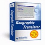
برنامج Geographic Translator v3.0 بالكراك

الإخوة الكرام .. برنامجنا اليوم هو Geographic Translator v3.0 كاملاً بالكراك
نبذة عن البرنامج
The Geographic Translator supports comprehensive data and coordinate system translation of map files in AutoCAD DWG & DXF, Microstation DGN, MapInfo MIF & TAB, and ESRI Shapefile and ArcInfo Interchange (.e00) formats. Version 3.0 supports all the latest versions of these formats. \"Hands free\" batch mode operation is another compelling reason to add this new Blue Marble tool to your GIS toolbox. Time tested and production proven core component technology from the Blue Marble\'s intelligent map display tool GeoObjects and GeoCalc, the world\'s leading coordinate conversion library, are leveraged in the Geographic Translator
رابط التحميل
http://216.69.143.120/downloads/prod...slator30my.exe
او
http://www.4shared.com/file/TtplxMMC/Geographic_Translator.htm
الكراك
http://*******************/endown/shkg3t04-2006-03-01.rar
أسأل الله تعالى أن ينفعكم به , والله الموفق
والسلام عليكم ورحمة الله وبركاته.
--
تحياتي
مصدر الموضوع إليكم .. - منتديات الهندسة نت
